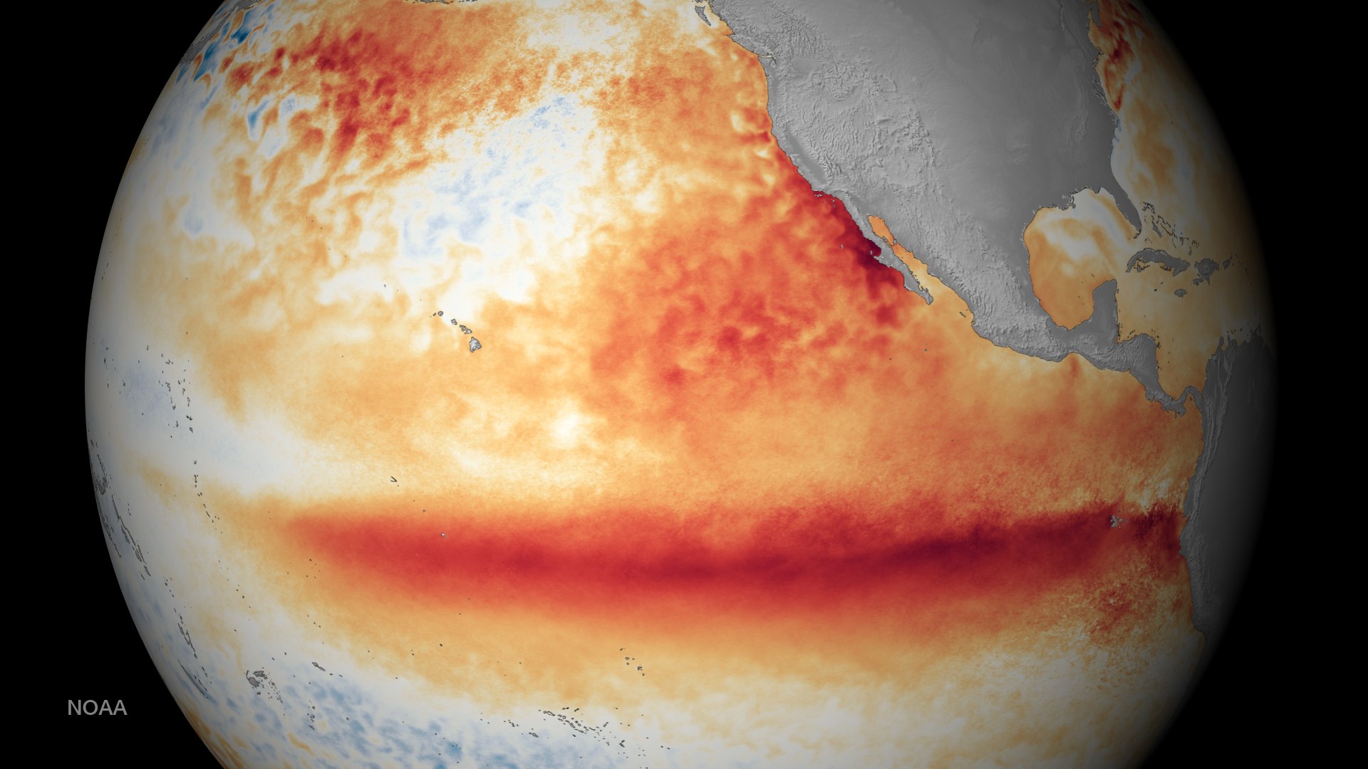
This winter’s El Niño may be the strongest on record. NOAA’s Climate Prediction Center says a “strong-to-very strong” El Niño is likely through January to March 2027. It gives an 83% chance that the October to December reading will beat the 1982–83 record. The next NOAA update is due November 12.
Outlooks for western Canada all point the same way: El Niño usually means a milder, often drier winter for us. But “usually” isn’t a promise. So instead of leaning only on general predictions, we went back to Lethbridge’s own weather records to see what actually happened here in the three big El Niño winters of the past 45 years.
What Lethbridge actually got
These numbers cover November 1 to March 31 at the Lethbridge Airport weather station. “Normal” is the average of the 30 winters from 1990–91 to 2019–20, worked out the same way.
| Nov to Mar | Normal | 1982–83 | 1997–98 | 2015–16 |
|---|---|---|---|---|
| Average temperature | −3.6°C | −2.1°C | −3.8°C | −1.4°C |
| Dec to Feb average | −5.2°C | −2.0°C | −4.8°C | −3.1°C |
| Nights at −20°C or colder | 18 | 9 | 23 | 7 |
| Nights at −30°C or colder | 4 | 0 | 5 | 0 |
| Days reaching 10°C or warmer | 25 | 20 | 28 | 38 |
| Precipitation (rain and melted snow) | 68 mm | 73 mm | 53 mm | about 40 to 53 mm* |
| Snowfall | 74 cm | 68 cm | 51 cm | about 39 cm* |
*The airport station stopped measuring snowfall in 2012, and some winter days are missing from 2015–16. The 2015–16 snowfall is from the Lethbridge research station, and the precipitation range covers both stations. Both show a clearly dry winter.
Three El Niños, three different winters
1982–83: the mild one. The December to February average was more than 3 degrees above normal. We had half the usual number of −20 nights and not one night at −30. February 1983 averaged above freezing, about 5 degrees warmer than a normal February. Precipitation and snowfall were close to normal, so it was mild but not especially dry.
1997–98: the surprise. Over the whole winter this one came out almost exactly normal. That’s because January 1998 was brutal. It averaged −11.3°C, more than 5 degrees colder than a normal January, and the airport hit −38.7°C on January 12. Then February flipped to mild and nearly bone-dry. It’s the best local reminder that a strong El Niño does not rule out a deep cold snap.
2015–16: the textbook one. It was warm and dry. We had only 7 nights at −20 and none at −30, and 38 days reached 10°C or warmer, half again the usual number. February and March were both several degrees above normal, and snowfall was roughly half of normal.
One more worth remembering: the strong El Niño of 2023–24 still gave us the deep freeze of January 2024, when the airport dropped to −41.5°C on January 13. A warm winter on average can still have a dangerous week.
What we’ll be watching this winter
- Cold outbreaks. How often Arctic air reaches us, and for how long. Two of the four strong El Niño winters above still had serious cold snaps.
- Precipitation compared with normal. Two of the three big events left Lethbridge drier than normal. A dry winter matters for farm soil moisture, grass fire risk and next year’s crops.
- Mountain snowpack. Our rivers, reservoirs and irrigation water start as snow in the Rockies. That includes the St. Mary and Waterton headwaters in Montana’s Glacier National Park. NOAA’s outlook leans toward a drier winter for the northern Rockies, so the snowpack reports will be worth watching closely.
We’ll follow how this winter compares as it goes. Keep an eye on Yesterday at the Station for daily readings and our Forecast Scorecard to see which forecasts are getting it right. For the science behind El Niño and chinooks, see Weather School.
How we did this: daily records from Environment and Climate Change Canada for Lethbridge Airport (climate IDs 3033880 to mid-2012, then 3033875), November 1 to March 31 each winter, with snowfall for 2015–16 from Lethbridge CDA 2 (3033892). Outlook: NOAA Climate Prediction Center ENSO Diagnostic Discussion, October 8, 2026. Past results don’t guarantee what this winter will bring.
Top photo: ocean temperatures compared with normal in October 2015, during the strong 2015–16 El Niño. Warm colours along the equator in the Pacific are the El Niño. Image: NOAA (public domain).