How our coulees were made: the story of the land under Lethbridge
The coulees, the river valley, the coal, the giant boulders on the prairie: the land around Lethbridge is a history book written in stone. Here’s how to read it.
Chapter 1: an ancient sea (about 75 million years ago)
Long ago, a huge, shallow sea stretched across the middle of North America. Southern Alberta was its shoreline: swamps, rivers and beaches where dinosaurs walked and ammonites swam. Over millions of years, layers of sand, mud and plants piled up and hardened into sandstone, shale and coal.
Look at a coulee wall and you can see those layers like stripes in a cake. Each stripe is a slice of time.
Chapter 2: black rocks and the start of a city
The Blackfoot knew the coal in the river banks. They called the area the place of the black rocks. In 1874, Nicholas Sheran opened the first commercial coal mine in Alberta, on the west bank of the Oldman River. Soon the Galt family’s mines grew into a town, and the town became Lethbridge. The city was built on coal!
Learn more at the Galt Museum & Archives.
Chapter 3: the ice age
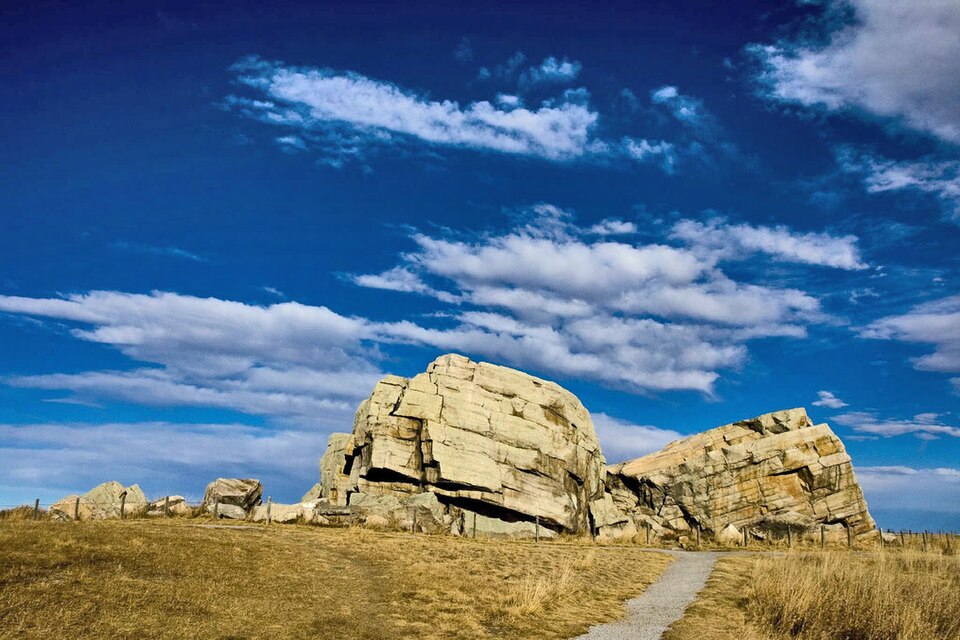
Much more recently, during the last ice age, a huge ice sheet hundreds of metres thick covered the prairies. As it moved, it scraped the land and dropped a blanket of clay, sand and boulders called glacial till, in places up to 100 metres thick.
Chapter 4: the great melt carves the coulees
When the ice began to melt, about 12,000 years ago, enormous amounts of meltwater were trapped against the ice, making big lakes around Lethbridge. When the water broke free, it rushed across the land and carved deep channels. Those channels are our coulees and river valleys. That’s why the valleys look far too big for the small rivers in them today.
Chapter 5: still changing today
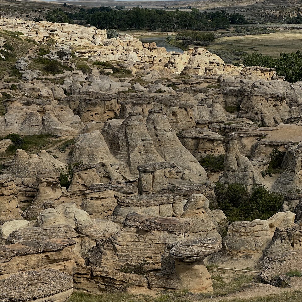
- Wind and water keep wearing the coulees away. Rain washes grooves into the soft walls; our strong winds blow dust and sand.
- Hoodoos, the mushroom-shaped rock towers at Writing-on-Stone Provincial Park on the Milk River, form when hard layers of sandstone protect softer rock below them.
- Coulee slumps: sometimes chunks of coulee wall slide down. That’s why it’s important to stay back from edges.
✏ Try it yourself
- Read the layers: on a coulee walk with an adult, count the stripes you can see in a coulee wall. Draw them. Which are sandy? Which look dark like coal?
- Make a coulee: pile damp sand in a baking pan, put an ice cube “glacier” at the top end, tilt the pan and let it melt. Then pour a cup of water down the slope fast. What shapes does the water carve?
- Layer jar: put soil, sand and pebbles in a jar of water, shake it, and let it settle overnight. You’ll see layers form, just like sedimentary rock.
Weather and geology work together
The chinook winds that blow down the Rockies and the summer storms that wash the coulees are part of this story. See Chinooks and Weather Wonders.
❓ Quick quiz
Guess first, then tap to see the answer.
What did the Blackfoot call the Lethbridge area?
The place of the black rocks, because of the coal in the river banks.
Who opened Alberta’s first commercial coal mine, and when?
Nicholas Sheran, in 1874.
What carved the coulees?
Huge floods of meltwater at the end of the last ice age.
How did Big Rock get to the prairie?
It rode on a glacier from the Rocky Mountains.
🏫 For teachers and parents
- Ages: 8 to 14; links to Alberta grade 7 “Planet Earth” and local history in social studies.
- The ice cube and sand pan takes about 40 minutes and shows erosion beautifully.
- Timeline on a rope: stretch a 10-metre rope for 100 million years. The coulee-carving floods happened in the last millimetre or so!
- Field trips: the Helen Schuler Nature Centre in the river valley, the Galt Museum, and Big Rock near Okotoks.
- More ideas in the Teachers’ Corner.
More Earth Explorers
Sources: Oldman Watershed Council, State of the Watershed report (Prairie sub-basins); Galt Museum & Archives, We Built This City with Coal Mining; Okotoks Erratic, Alberta Provincial Historic Site records.